


Select NOAA-NWS Forecast Office Text Products
(Product availability varies with seasons, forecast office, and weather.)
Forecast Discussion for New York City/Upton, NY
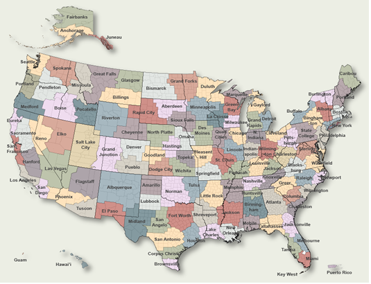
To Select Another NWS Office Click on Map or Choose from List
|
| Select Forecast Office: | Select Product: |
668
FXUS61 KOKX 172344
AFDOKX

Area Forecast Discussion
National Weather Service New York NY
744 PM EDT Fri Jul 17 2026

.WHAT HAS CHANGED...
A Flood Watch is now in effect for northeast NJ, NYC and southern
Westchester for Saturday into Saturday night.

There is now an Enhanced risk of severe weather for western
portions of northeast NJ, NYC and the Lower Hudson Valley.

There is a high rip current risk at all ocean beaches on
Saturday.

A Small Craft Advisory is now in effect for all but the NY
Harbor and western LI Sound for Saturday into Saturday night.

State DEPs/DECs have issued Air Quality Alerts for our entire
area for Saturday.

&&

.KEY MESSAGES...
1) Isolated to scattered severe thunderstorms and flash
flooding possible Saturday into Saturday night. A Flood Watch is
now in effect for northeast NJ, NYC and southern Westchester.

2) There is a high risk of rip currents for all ocean beaches on
Saturday. (See Marine section below for discussion)

3) Another round of showers and thunderstorms possible late Tuesday
into a portion of Wednesday.

&&

.DISCUSSION...
.KEY MESSAGE 1...
An upper level trough digs down into the Great Lakes Saturday
and swings across eastern Canada and the northeast US Saturday
night. Out ahead of this feature, shortwave energy passes
overhead Saturday afternoon. At the surface, a warm front moves
through in the morning followed by a pre-frontal trough in the
afternoon and then eventually a cold front in the
evening/overnight. These features will cause multiple rounds of
showers and thunderstorms for the area from Saturday through
Saturday night. Both severe weather and flash flooding is
possible.

Confidence is now high enough to issue a Flood Watch for northeast
NJ, NYC and southern Westchester. There is potential for this Watch
to expand, but for now have higher confidence in these more
sensitive urban areas. While storms will likely be quick moving, it
is the possibility of seeing multiple rounds of heavy downpours that
is causing the flash flood risk. Latest NAM and GFS continue to show
pwats reaching between 2 and 2.25 inches. This is well above the
observed 90th percentile per OKX RAOB climatology. Peak hourly
rainfall rates are expected to be upwards to 1.5 to 2.0 inches.

The SPC has upgraded western portions of northeast NJ, NYC and
the Lower Hudson Valley to an enhanced risk of severe weather.
There continues to be some uncertainty with the amount of
destabilization given the multiple rounds of convection,
lingering smoke and clouds. Thinking the most likely scenario
for severe weather will be with the pre-frontal trough during
the late afternoon/early evening. If we can`t clear out after
earlier warm advection activity, the severe threat may be a bit
lower. Ahead of the pre-frontal trough, latest CAMs have the
area destabilizing to about 1000-2000 J/kg of MLCAPE, with
~1000 J/kg of DCAPE. Wind profiles aloft are also resulting in
~40 kt of EBWD and strong low level curvature. The main threat
with any severe storms will be damaging wind gusts, with the
potential for an isolated tornado.

.KEY MESSAGE 3...
An upper level trough over Canada just north of the Great Lakes
region will be the driver of the upcoming weather for Tuesday and
into Wednesday. Model guidance has generally good agreement on an
amplified shortwave trough approaching the area Tuesday morning, and
bringing rain showers and embedded thunderstorms Tuesday afternoon
through the first half of the day on Wednesday. The best chances for
any storm development looks to be between Tuesday afternoon through
Tuesday evening, but a isolated storm going into the overnight hours
can`t be ruled out. Rain showers will continue into the day on
Wednesday, with another small chance for isolated storms in the
morning and early afternoon, before surface high pressure builds in
from the west, cutting off chances for precipitation heading into
Wednesday evening. Going into the end of the week, general high
pressure weather with low chances for precipitation is currently
forecast through the end of the week.

&&

.AVIATION /00Z SATURDAY THROUGH WEDNESDAY/...
High pressure will remain over the area through much of tonight
before giving way to an approaching frontal system on Saturday.
The latter will send a warm front through the area during the
late morning/early afternoon hours Saturday, followed by a cold
frontal passage Saturday night.

This will be primarily a VFR forecast through tonight before
several rounds of showers and thunderstorms move through the
area on Saturday with MVFR or lower conditions. The greatest
uncertainty will be the increasing concentration of smoke in the
low levels returning tonight into Saturday morning. The latest
HRRR shows the greatest concentration between 12Z and 18Z
Saturday. MVFR vsby restrictions possible in the smoke.

Coastal terminals will likely see a wind shift to the south this
evening, while inland terminals may just go from NW to light
and variable overnight. SW/S winds increase to 10-15 kt with
G20-25kt on Saturday, highest at the eastern terminals. Low
chance for SW LLWS below 2kft.

 ...NY Metro (KEWR/KLGA/KJFK/KTEB) TAF Uncertainty...

Wind shift to the S/SE or light and variable this evening at
KEWR may vary by 1-2 hours.

Chance of MVFR developing in smoke this evening and persisting
through Saturday morning. Low confidence of IFR or lower in the
smoke.

.OUTLOOK FOR 00Z SATURDAY THROUGH TUESDAY...

Saturday night: MVFR or lower with showers/tstms early. SW/S
winds G20-25kt in the early evening, then gradually
diminishing.

Sunday and Monday: Mainly VFR.

Tuesday and Wednesday: MVFR or lower with showers/tstms.

&&

.MARINE...
A Small Craft Advisory is now in effect for all but the NY
Harbor and western LI Sound for Saturday into Saturday night.
Winds will likely just reach 25 kt, with 5 ft seas for the ocean
zones.

Conditions are then quiet until the next cold frontal passage
in the middle of next week. SCA conditions look possible Tuesday
through Wednesday night, with the potential of 7 to 10 ft seas.

Rip Currents:

The overall rip current risk is low today with light S/SW winds
at or under 10 kt and S swells 1-2 ft at 5 sec periods.

There is a high rip current risk now in effect for Saturday. A
strengthening southerly flow at 15 to 20 kt and a resulting wind
wave will be the main cause. There is also a SE swell around 1
foot at 14s.

On Sunday, the high risk likely only continues for Suffolk
County and during the morning hours. Guidance is showing a
lingering 5 to 6 ft swell at 7s but Saturday`s winds.

&&

.OKX WATCHES/WARNINGS/ADVISORIES...
CT...Air Quality Alert until midnight EDT Saturday night for
     CTZ005>012.
NY...Air Quality Alert until midnight EDT Saturday night for
     NYZ067>075-078>081-176>179.
     Flood Watch from Saturday morning through late Saturday night
     for NYZ071>075-176-178.
     High Risk for Rip Currents from 6 AM EDT Saturday through Saturday
     evening for NYZ075-080-081-178-179.
NJ...Air Quality Alert until midnight EDT Saturday night for NJZ002-
     004-006-103>108.
     Flood Watch from Saturday morning through late Saturday night
     for NJZ002-004-006-103>108.
MARINE...Small Craft Advisory from noon Saturday to midnight EDT
     Saturday night for ANZ331-332-340-345.
     Small Craft Advisory from noon Saturday to noon EDT Sunday for
     ANZ350-353-355.

&&

$$

DISCUSSION...KL/JT
AVIATION...MW
MARINE...JT
|
Previous Forecast Discussions may be found at
NWS New York City/Upton, NY (OKX) Office Forecast Discussions.
(Click 'Previous Version' there to view past versions successively.
Some may differ only in time posted.)
Products Courtesy of NOAA-NWS
NWS Information Parsing Script by Ken True at Saratoga Weather - WFO and Products Scripts by SE Lincoln Weather.
Mapping by Curly at Michiana Weather and by Tom at My Mishawaka Weather.